Two new tile sets are now featured on the OpenStreetMap.org site. The
Transport Layer and the MapQuest Open layer both use the same Hot
Fresh OpenStreetmap data that we all know and love. Each tile set
presents that data in a different way, for a different audience by
making careful choices about how to render OpenStreetMap data.
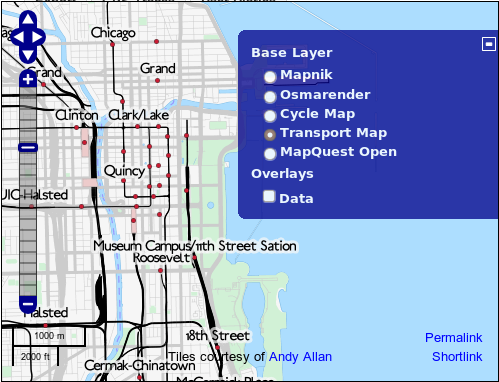
The Transport layer, courtesy of Andy Allan shows public
transportation infrastructure like subways and bus routes and train
stations.
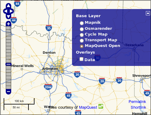
The MapQuest Open layer, courtesy of MapQuest shows highway shields and toll
roads.
Love the new transport map! Great work… thanks so much.
It`s a very good step, but it`s not enough . I cannot interact with the lines. In my city, bucharest, where we have over 300 transportation lines, i don`t understand nothing.From where a line it`s coming, where it is going, etc
@baditaforin . These new layers demonstrate different "<a href="http://wiki.openstreetmap.org/wiki/Rendering">renderings</a>" of OpenStreetMap data. It’s the powerful ability to take our raw vector data and create raster maps with a completely different look backed into the pixels of the map images. It has nothing to do with the way you interact with the map though. However access to raw data *can* enable more sophisticated interaction e.g. through javascript overlays. Technically that is a completely different undertaking, and not something we’re doing on the OpenStreetMap homepage (except with the general purpose ‘data’ tick box of course), but others have experimented with clickable transport overlays. For example check out <a href="http://3liz.fr/public/osmtransport/index.php?country=Romania&location=Bucuresti">OSMtransport for Bucharest</a>.
Hi,Is Trolleybus included in this? I can see the stops, but not the line. Does it support the "new" tagging scheme? http://wiki.openstreetmap.org/wiki/Proposed_features/Public_Transporthttp://www.openstreetmap.org/?lat=47.514835&lon=19.050205&zoom=18&layers=TThanks in advance.
I’m not sure about the answer to your specific tagging question, but you’re also asking specifically about the transport layer. This isn’t the best place to ask. This map style is designed, rendered and hosted by Andy Allan. You can read more about his transport map here: http://www.gravitystorm.co.uk/shine/archives/2011/04/11/transport-map/ and perhaps address your questions to him directly (although he’s a busy a man) We also a have a talk-transit mailing list which could be a good place to chat about these things: http://lists.openstreetmap.org/listinfo/talk-transit